 FAO Map Catalog
Contact for the resource
FAO - UN AGL Documentation Center
Type of resources
Available actions
Topics
Keywords
Contact for the resource
Provided by
status
Scale
From
1
-
10
/
962
-

Include: Kataragama (Map 67)
-

Include: Murunkan (Map 14)
-
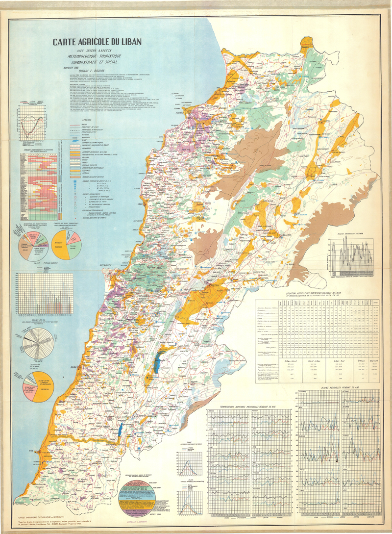
Carte agricole du Liban avec divers aspects météorologique-touristique-administratif et social (3ème édition)
-

Include: Passara (Map 56)
-
Include: Sumatra: Soil map of the project area, belitang Sumatra: Land capability map of the project area
-

Peta Tana TindJau Propinsi Sulawesi Selatan (500 000)
-
Special Publication No 2
-

Include: Rio Titihuapa (2457 II) - Soil Maps; Description of the mapping units
-
Cartes d'aptitude des sols pour la culture du mil
-
Include: Kohat (Map No 23)